Get Full Government Meeting Transcripts, Videos, & Alerts Forever!
Get email alerts on the Land Use Subdivision topic
No spam. Unsubscribe anytime.
Subdivision sketch for 1950 Hillview Drive raises deer-wintering and stormwater questions
Summary
At a March 11 Richmond DRB meeting, applicants proposed subdividing 1950 Hillview Drive (a 137-acre parcel) into a 109-acre lot and a 19.1-acre lot. Staff flagged a mapped deer wintering area overlapping a proposed building envelope and recommended either shifting the envelope or providing a biologist’s assessment; stormwater and septic permitting were also raised by neighbors and board members.
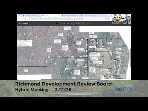
Brian Courier of Larry Burke Civil Associates presented a sketch subdivision for SK 2025-00008 at the Town of Richmond Development Review Board meeting on March 11, asking to further subdivide the 137-acre parcel at 1950 Hillview Drive into a roughly 109-acre lot and a 19.1-acre lot and to record a boundary-line adjustment. Courier said the proposal would move a building envelope and extend an existing rural road about 200 feet with a turnaround so the project would remain below Richmond’s threshold that triggers road-standard requirements.
Dante, planning staff, told the board that a 2012 approval had included a condition that if the large rear parcel were subdivided in the future the DRB would consider whether a professional assessment of deer wintering areas was needed. Dante provided an ANR atlas map showing a mapped deer wintering area overlapping the proposed envelope. Courier said the applicant is willing to shift the envelope away from the mapped area or provide a professional assessment to address the criterion.
Board members asked for clarity on which features on the plan were previously recorded and which are new. The applicant said the three original building lots were recorded and remain buildable; Lot 3 was reduced previously from about 9 acres to 5.2 acres by a boundary-line adjustment. Courier also confirmed existing wastewater permits for the 2012 lots but said new septic design and permitting will be required where building sites move.
Several neighbors and online commenters asked about streams and runoff. Chelsea (chat) asked whether the two blue-line streams on the retained parcel must be shown on final plans; staff and the applicant said mapped streams will be included and that a stream-alteration permit would be required if any stream is crossed. Rachel Gray, who joined on camera, described existing runoff over Blueberry Farm Road during heavy rain and urged that increased runoff be addressed in subsequent plans: “there is a stream ... it does run down and then crosses the Blueberry Farm Road ... with significant [rainfall] those culverts already are really stressed,” she said.
Staff and the board discussed stormwater jurisdiction and construction-permit thresholds. Dante noted that state operational stormwater permits often rely on a 10‑year design event while Richmond’s development standards reference a 25‑year design criterion for required stormwater treatment; the town and applicant agreed that the state will make the jurisdictional determination and that mapped stream crossings will require additional permitting and coordination with the rivers program. The board also flagged the “common plan of development” / construction disturbance threshold (one acre) as important for future submittals.
Outcome and next steps: Because this was a sketch plan review, the DRB provided input and did not issue a final decision. The applicant was advised to: shift building envelopes away from mapped deer wintering areas or provide a professional assessment; show streams and any proposed crossings on future plans; confirm septic locations and permits where building envelopes change; and obtain any state stormwater determinations before submitting final materials.