Get Full Government Meeting Transcripts, Videos, & Alerts Forever!
Get email alerts on the Zoning Map topic
No spam. Unsubscribe anytime.
Gary Plan Commission votes 5–0 to recommend 2026 citywide zoning map to City Council
Summary
The Gary Plan Commission voted unanimously to certify the proposed 2026 citywide zoning map to the Gary Common Council, locking base zoning designations while allowing staff to fix clerical color/label errors; staff highlighted a new parcel‑level GIS viewer and a FEMA flood‑plain overlay.
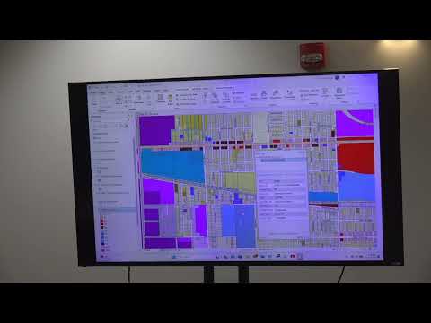
The Gary Plan Commission on June 24 voted 5–0 to recommend certification of the proposed 2026 citywide zoning map to the Gary Common Council, with the understanding that staff may make clerical color and labeling corrections before Council adoption.
Staff presenters said the map updates the city’s zoning to align with the new Unified Development Ordinance and the comprehensive plan. They described a four‑part evaluation used to assign zones: current use, comprehensive‑plan guidance, nearby infrastructure (streets, sanitary, water, electric and sewer), and readiness for likely new development. According to staff, the map consolidates residential, multiple business tiers, destination districts, mixed‑use and manufacturing zones into a single citywide layer intended to reflect on‑the‑ground uses.
Staff also demonstrated a planned live GIS viewer that will allow users to zoom to individual parcels and view parcel‑level attributes, permitted heights, lot coverage and links to code provisions. The presenters said the GIS will integrate with permitting and inspections so developers and residents can readily confirm allowed uses and development standards.
During the presentation staff highlighted a FEMA‑designated flood‑plain overlay on the map. Staff said the overlay is not a separate base zone but an additional regulatory layer that signals where federal flood‑plain requirements and environmental considerations apply; the overlay will show whether portions of a parcel are subject to those requirements while the parcel retains its base district designation.
Commissioners asked whether closed school sites would be rezoned proactively. Staff answered that parcels identified as residential in the comprehensive plan were being rezoned to be “zone ready,” while school‑owned properties not in the comprehensive plan would remain designated as destination/school until a development proposal prompted rezoning. Staff noted some mapping data cross‑overs that created display glitches in the PDF version and said those clerical issues would be corrected in the digital system without changing the underlying zoning decisions.
At the public comment period, John Allen of Glenn Park (3544 Van Buing) said, “I’m for the zone. I think it’s a great idea,” and asked whether the 2300 block of Jackson Street would be treated as a destination zone; staff replied that the parcel at 2303 Jackson is shown as a destination parcel while adjacent properties would require individual rezoning requests for new uses.
Commissioner Jeremiah King moved to grant a favorable recommendation to certify the proposed official zoning map to the Gary Common Council for adoption, subject to clerical corrections; a commissioner seconded the motion. Roll call recorded five yes votes, zero no votes, and the commission’s favorable recommendation was certified to Council.
The commission’s action is a recommendation only; final adoption will be decided by the Gary Common Council. Staff said the online GIS and any clerical color/label corrections will be completed before the item goes to Council.