Get Full Government Meeting Transcripts, Videos, & Alerts Forever!
Get email alerts on the Riverfront Redevelopment topic
No spam. Unsubscribe anytime.
New Milford committee presents riverfront master plan with park, traffic changes and mixed‑use option
Summary
The Riverfront Revitalization Committee and consultants from WXY and Langan presented a draft master plan for more than 50 acres of publicly controlled riverfront land in New Milford, including a multifunctional park, a proposed relocation of Youngsfield Road to create a new signalized intersection, and a potential 200–250 unit mixed‑use area to help fund the project.
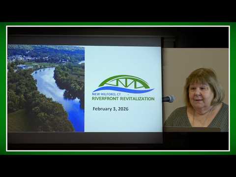
Leba Fuhrman, chair of the Riverfront Revitalization Committee, opened a public workshop Tuesday to present a draft master plan intended to reconnect downtown New Milford with more than 50 acres of publicly owned riverfront land.
"You have the final word," Fuhrman said, stressing that the plan is a long-range, staged effort that will require further design, town approvals and additional funding. She reviewed the project's history, noting it grew out of community opposition to a 2016 Panda Power proposal and that the committee was appointed in 2017 and made permanent by ordinance in 2020.
David Vega Barakowitz, project manager for design firm WXY, said the team is roughly halfway to three‑quarters through the design development phase and based its current proposals on a public workshop and an online survey that drew more than 400 responses, about 97 percent from full‑time New Milford residents. "We heard a lot of focus on natural areas, water, restrooms and more cultural programs," he said.
The plan is organized into four zones: a primary park area along Youngsfield Road with a flex lawn, amphitheater and accessible switchback paths; a mixed‑use zone near the town’s Department of Public Works storage area; an upgraded active‑recreation cluster around Helen Marks Park; and a conservation area at Native Meadows. WXY proposed amenities including an amphitheater with restrooms and a green room, a nature pavilion, kayak access with a removable launch point, public art and stormwater features designed to function as a "sponge park" during heavy storms.
Chris McClain, a traffic engineer with Langan Engineering, described the team's traffic analysis and two circulation options. The firm's preferred Option A would relocate and consolidate Youngsfield Road to create a clustered, signalized intersection at Patriot's Way, Railroad Street and Bridge Street; McClain said the change would reduce safety risks from left‑turn conflicts and could improve Railroad Street from a level‑of‑service E to about a C once implemented with signal coordination. He noted that Connecticut Department of Transportation (DOT) approval will be required because Bridge Street is a state corridor.
To help fund construction and operations, the consultants presented an initial financial approach that includes a potential mixed‑use development of roughly 200–250 housing units (a mix of townhomes and larger buildings that could include senior housing or condominiums). Barakowitz said that configuration was an early target to support project feasibility but that alternatives and siting remain open to feedback. The team said the reconfiguration would create roughly a net increase of about 86 parking spaces in the redesign (not including parking supplied within future mixed‑use buildings).
Fuhrman described funding so far: an initial $170,000 Brownfield planning grant, use of federal American Rescue Plan Act funds through the town, and a $200,000 award from Connecticut’s Brownfield Assessment Program that was provided to the Corporation for New Milford Economic Development to support assessment and site analysis. She said no local tax dollars have been spent on planning and design to date and reminded residents that any major expenditure or sale of town‑owned property would require town meeting approval under the town charter.
During a roughly 15‑minute question period, residents pressed the team on building height and visual impacts, kayak access in silty river conditions, noise from amphitheater programming, parking for future residents and the scope of economic analysis. A kayaker who said he had helped build an earlier launch asked how the design would cope with silt; Barakowitz said a permanent launch concept with a removable launch point is being considered but that hydraulic and siting details would require further design work. On acoustics and hours for live events, Fuhrman and the consultants said specific programming rules and mitigations (for example, berms or tree buffers) are unresolved and would be set later, in line with town event practices.
The committee reiterated next steps: WXY will prepare a proposed implementation budget and the team will continue to refine designs and coordinate with DOT and other agencies (including Army Corps and state environmental regulators). Attendees were invited to an adjacent open‑house to view boards and a fly‑through video and were given two ways to submit written comments: riverfront@newmilfordct.com or mail to Riverfront, 10 Main Street, New Milford.
Fuhrman closed by thanking the consultants and town staff and reminding residents that public input will shape the detailed design and implementation schedule.