Get Full Government Meeting Transcripts, Videos, & Alerts Forever!
Get email alerts on the Beach Overlay District topic
No spam. Unsubscribe anytime.
Kiawah Island workshop advances Beach Overlay District as homeowners warn Zone B could make properties nonconforming
Summary
Council and planning staff outlined a proposed Beach Overlay District to protect dunes and shoreline habitat; conservationists urged strong buffers while Eugenia homeowners pressed for precise maps and clearer language about rebuild rights and economic impact. Staff said revised language will return to the planning commission before a second reading.
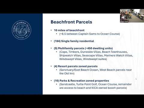
KIAWAH ISLAND, S.C. — Town staff and council members on March 21 presented a proposed Beach Overlay District intended to protect dunes, maritime forest and the island’s oceanfront character, while residents—particularly from Eugenia—pressed for clearer ordinance language and parcel-level maps showing how the overlay’s 50‑ and 100‑foot buffer zones would fall on private property.
Town planning staffer John said the overlay is designed to align with the town’s recently adopted comprehensive plan and to preserve natural buffers as “important resilience, natural infrastructure,” protecting the beachfront from more frequent, unpredictable storms. “This proposed beachfront overlay is consistent with the comprehensive plan,” he said, adding the ordinance would prioritize native vegetation and buffers and aim to create consistent standards across many different base zoning districts.
The town intentionally drafted the overlay to allow repairs and routine renovations without forcing owners to rebuild to new standards, staff said. Under the current draft, owners may maintain an existing footprint after a casualty loss and make repairs without extending nonconformities; by contrast, a complete teardown or new construction would generally need to meet the overlay’s new setback standards. Staff said they are exploring administrative-relief procedures so owners would not have to pursue a variance in every case.
But multiple homeowners from Eugenia said the proposed Zone B buffer—roughly the second 50‑foot band landward of the state’s 2018 jurisdictional line—appears to run into backyards and, in some cases, through homes. “You’ve just taken away now we don't have anything there…That’s 25%,” said Lee Oluski, a homeowner on Eugenia, describing his estimate that 50 feet of a 200‑foot lot depth would be rezoned and might affect future resale. Owners repeatedly asked for parcel-level depictions and urged the town to show exact lines for streets so families could see the overlay’s real impacts.
Staff replied that the town’s mapping tool is accurate for planning purposes but not a legal survey and that property owners would need surveys to determine precise jurisdictional lines. Staff offered to run street‑level overlays and said they could provide line depictions for affected streets “in the next couple of days” to help homeowners determine where buffers fall. They also noted the proposed ordinance currently references the 2018 state jurisdictional line; the state’s survey update (phase 2) covering Kiawah may not be finalized until 2027–2028, and the council is considering whether to lock to 2018 or build automatic transition language tied to the future state line.
Conservation groups urged strong protections. “I would urge the council and the planning commission not to negate the importance of buffers,” said Stephanie Robinson of the South Carolina Coastal Conservation League, warning that removing buffers elsewhere has led to severe erosion and property loss on other coastlines.
Homeowners also raised practical questions about lot coverage, insurance and landscaping. One presenter said many R‑1 parcels are at or near the town’s 33% lot‑coverage cap, which means most homeowners already lack room to expand without a variance—reducing how many properties would need to be moved landward to meet new setbacks. Residents asked whether existing landscaping and artificial turf in a buffer would be grandfathered; staff said the ordinance treats hardscape improvements differently from soft landscaping and pledged clearer wording in the next draft.
No formal vote was taken: the session was a workshop to gather feedback and refine the ordinance. Mayor (speaker 1) and staff said the council and administration will incorporate comments, adjust language to provide more certainty about administrative relief and casualty‑loss rules, circulate the revised draft to the community, and send the language back to the planning commission for recommendation before a second reading. “You will have an ample opportunity to review that draft,” the mayor said.
The workshop closed with staff commitments to provide parcel‑level overlays for affected streets and continue outreach; planning commission and council meetings will follow before the ordinance proceeds to a council second reading.