Get Full Government Meeting Transcripts, Videos, & Alerts Forever!
Get email alerts on the Model Technical Findings topic
No spam. Unsubscribe anytime.
Modeling team: coupled Shasta River model shows large hypothetical increases under 'unimpaired' scenario; presenters flag data gaps on springs and pumping
Summary
A technical presentation of the Shasta surface‑water/groundwater model showed the coupled LSPC–MODFLOW framework can reproduce observed flows at the watershed mouth but also produces significant hypothetical gains under an ‘unimpaired’ scenario; presenters and commenters stressed that spring validation and missing pump/location data remain important limits.
Presenters at the May 7 webinar described technical findings from a newly posted Shasta River watershed model and flagged several areas where additional local data are needed to increase confidence in regulatory or management use.
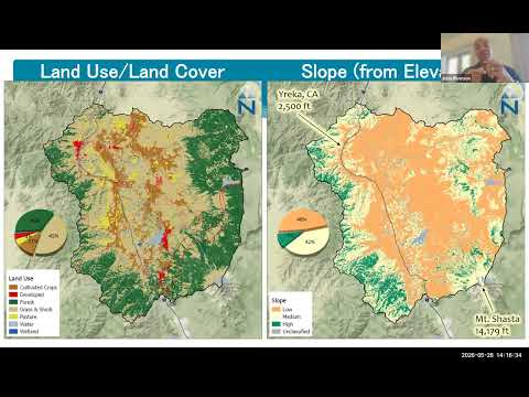
The technical team — John Riverson (Alltech), Vivek Berekar (SS Papadopoulos & Associates) and Shahab Araghanajjad (State Water Resources Control Board) — described a coupled modeling approach that uses LSPC for surface hydrology and MODFLOW for groundwater, iterating between the two to simulate exchange (described in the presentation as GWE/"aglow"). Riverson emphasized a configuration‑over‑calibration approach and argued the coupled model gives a more comprehensive evaluation of recharge, pumping impacts and return flows.
Key technical takeaways: the modelers reported reasonably strong agreement between modeled and observed flows at the mouth of the watershed after coupling; their unimpaired scenario (turning off diversions, irrigation, reservoir and pumping) shows large hypothetical increases in downstream discharge — for example, an average delta of roughly 140 cubic feet per second at Yreka in the model’s 1991–2023 average comparison, and a locally large percent increase immediately downstream of Duenelle Reservoir under the unimpaired test. Riverson cautioned these figures are hypothetical bookends that depend on the assumptions and available data used in the runs.
Presenters and attendees repeatedly identified data gaps that affect model performance: missing pumping locations and schedules, sparse high‑frequency records at key springs (the Big Springs Complex was cited repeatedly), and occasional mismatches in reservoir operational timing. Vivek noted that several documented springs are simulated at or near zero discharge in the posted model and said: "more information...specific time series...would be super helpful for us to then represent that appropriately in the model and try and history match." John and Vivek said a separate water‑temperature tool and an allocation model (with Stockholm Environment Institute) will use the hydrology outputs but that ecological/temperature outcomes require additional data.
What the modeling team will do next: incorporate written public comments and any newly shared datasets into the model as feasible, then proceed to CalEPA external peer review; the team also plans a visualization/download tool so stakeholders can inspect model inputs and selected outputs after the comment/peer‑review period.
Quotes from the meeting include John Riverson’s methodological note that "all models are wrong, but some are useful," used to frame the team’s intent to be cautious in calibration. Attendees urged the team to consider extending the simulation period to include newly available 2025 gauge records for key springs and to provide clearer links in the documentation between remote‑sensing/ET inputs and applied irrigation volumes for particular subcatchments.