Get Full Government Meeting Transcripts, Videos, & Alerts Forever!
Get email alerts on the Land Management topic
No spam. Unsubscribe anytime.
Carlisle launches pilot process to write long-term management plan for Fox Hill
Summary
Town staff held a pilot public meeting to gather community input on Fox Hill, a little over 11 acres of town-owned conservation land. Residents raised concerns about process, asked for scientific surveys and monitoring, and suggested uses such as temporary art, trails and continued agriculture; staff will compile comments and present a draft plan to the conservation commission.
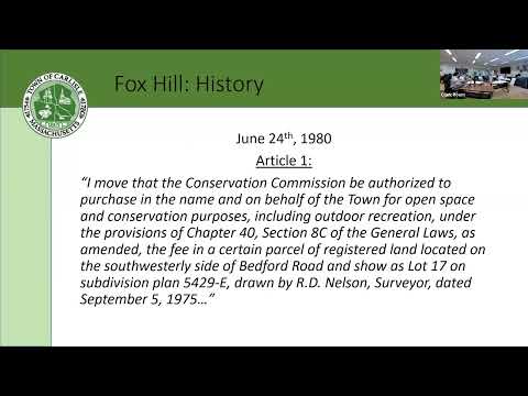
Carlisle held the first public meeting in a pilot process to develop long-term land-management plans for its conservation properties, focusing on Fox Hill — a little over 11 acres the town acquired after a special meeting in June 1980.
"My name's Sarah. I'm the land use and sustainability coordinator for the town," Sarah said as she opened the meeting and explained the three-step approach: document the past, assess the present and gather community ideas for a future draft plan. She said staff will compile the feedback, share a draft with the conservation commission and hold a second public meeting before any final action.
Participants confirmed the site's recent and historical uses: passive recreation, occasional mowing, and long-standing agricultural leases. Sarah said an agricultural license approved last March remains in effect through 2029. Residents and staff also recounted previous proposals — a 1993 land-swap and a 2001 septic proposal — that were discussed and ultimately not pursued after public opposition.
Several residents urged that the pilot produce more than an item-by-item checklist. "So far, this process has not generated dialogue about long-term management," Alex said, arguing the town should pair parcel-level work with a townwide assessment of needs and resources so recommendations are concrete and budgetable. Alex also urged the group to avoid an artificial rush: the current agricultural license covers several years, so there is time to build a robust process.
On the call, Ryan, identified by staff as the town administrator, said the pilot was intended to generate the community input that had been missing from past iterations. He added that the finance committee wants to understand the total investment and cost of management across properties to inform budgeting.
Several participants — including Christina — pressed for more scientific data and repeatable surveys. "We need to gather information as well," Christina said, urging flora and fauna surveys, soil analysis and, where useful, outside expertise such as a state forester or paid consultants. Residents said the town has archival photos, GIS aerials and a 2006 management plan that staff has been digitizing; they suggested standardized photo points and periodic monitoring to track invasive-species spread and forest encroachment.
Practical uses and management ideas emerged during an open discussion. Residents proposed formally allowing temporary, non-permanent art displays; creating trail connections and looped paths to Kimbell Farms; and clarifying how grazing and haying are permitted and administered. Speakers emphasized structuring agricultural licenses to encourage long-term land stewardship (for example, reseeding commitments) and discussed water logistics for livestock, including historic use of trucked tanks and the possibility of storage tanks or slow solar pumping.
Invasive species and tree encroachment were recurring concerns. Participants identified burning bush, oriental bittersweet, common and glossy buckthorn, multiflora rose and Norway maple as present on field edges and in understory areas. Residents asked that management decisions prioritize removing invasives while being selective where nonnative patches may provide habitat.
No formal votes or motions were taken. Sarah said she will compile the notes, circulate minutes and the online form responses, and bring the compiled input to the conservation commission as staff prepares a baseline assessment and draft management plan. A second community meeting will follow once the draft is available.
The process is designed to be iterative: community feedback will inform the baseline assessment and the draft, and the conservation commission — the regulatory body responsible for final approvals — will consider the draft in a public meeting before any plan is adopted.