Get Full Government Meeting Transcripts, Videos, & Alerts Forever!
Get email alerts on the Forum Launch topic
No spam. Unsubscribe anytime.
Census Bureau launches first GeoForum to spotlight geographic data and partnerships
Summary
The U.S. Census Bureau opened its first GeoForum to showcase TIGER/TIGERLine mapping products, partnerships that maintain boundaries and addresses, and federal uses of geographic data; speakers urged attendees to use new viewers and partner tools.
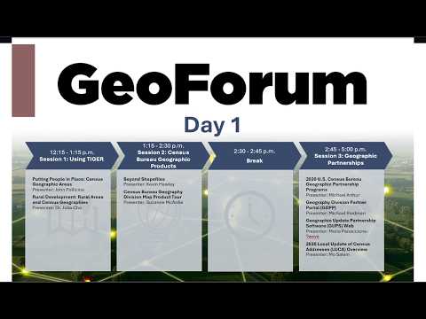
The U.S. Census Bureau opened its first GeoForum with a series of presentations aimed at users of geographic data and mapping tools. The virtual event, introduced by the forum host and Deborah Stempowski, associate director for decennial census programs, was described as a two‑day conference “to give you a lot of exposure to information across our geography — our geographic data, our products, and our programs,” Stempowski said.
Organizers said sessions will include demonstrations and technical briefings for users of TIGER/TIGERLine files, mapping viewers and partner programs that help keep addresses and boundaries current. Andrea Johnson, acting chief of the Census Bureau’s geography division, said the forum continues the agency’s longstanding practice of sharing national datasets and modernizing mapping tools, and that recordings and materials will be posted to Census Academy after the event.