Get Full Government Meeting Transcripts, Videos, & Alerts Forever!
Get email alerts on the Floodplain Management topic
No spam. Unsubscribe anytime.
Staff outlines mapping, recovery and floodplain standards after Helene
Summary
A Buncombe County floodplain manager told the planning board the county passed an NFIP community assistance audit, mapping updates with LIDAR are under way and recovery programs include elevation, buyouts and stream restoration.
The Buncombe County floodplain manager told the planning board that the county has been a member of the National Flood Insurance Program since 1980 and that the county recently passed a NFIP community-assistance audit. "We have been a member of the National Flood Insurance Program since 1980," the manager said, describing the county's role as a local administrator for some municipalities and the state's role as a cooperating technical partner.
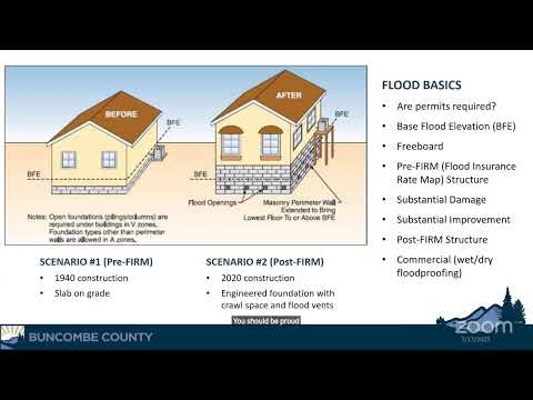
The manager described the mapping process and said the state is flying LIDAR this month as the first step in the next map cycle, which staff expect to take three to four years. He also explained differences between floodway, 100-year (1% annual chance) and 500-year (0.2% annual chance) zones and said Helene produced flooding in parts of Swannanoa that exceeded previous 500-year estimates. The presentation emphasized inspections, permitting, and the practical differences between pre-FIRM and modern elevated construction.