Get email alerts on the Transit Oriented Development topic
No spam. Unsubscribe anytime.
North Spokane transit‑oriented development study advances; county recommends two nodes for priority work
Summary
Planners updated the commission on a grant‑funded study to evaluate Division Street transit‑oriented development (TOD). Consultants scored multiple corridor nodes; county staff recommended prioritizing Northgate and Mead for deeper analysis and tying results into the 2026 plan update.
Spokane County planners reported progress on a grant‑funded study to identify and evaluate potential transit‑oriented development (TOD) nodes along the Division Street corridor and said the county will press for deeper study at two northern nodes.
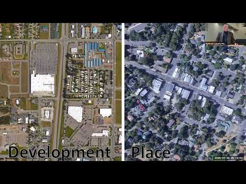
Sagan Nieman, a county planner, described TOD “at its most basic sense” as mixed use and higher densities oriented around a transit station so people can travel without relying on cars. The study — funded through a Spokane Transit Authority (STA) grant and coordinated with WSDOT and the city — scored 11 corridor nodes and selected four county nodes for possible evaluation: the Y, Whitworth, Mead and Northgate. Consultants ranked nodes on factors such as vacant land, connectivity and housing density.
County staff told the commission that, while consultant scores favored city nodes overall, local knowledge supports prioritizing Mead and Northgate for the county’s portion of the work because of development activity, a major medical/job center near MeadWorks and potential park‑and‑ride and station locations along the Hastings–Farwell corridor. “We will probably be able to have the funding for the consultant to evaluate 2 of those nodes,” Nieman said.
Why it matters: the Division Street corridor is tied to longer‑range regional transportation investments, including a proposed bus rapid transit (BRT) service. Planners said coordinating long‑range transit infrastructure with land‑use designations can help shape walkable, mixed‑use places and increase the likelihood that transit investments serve dense, connected development.
Details from the update
- Study scope: The project evaluates nodes identified in the Division Connects planning work and will recommend zoning and comprehensive plan designations that support TOD around future stations. STA’s BRT concept (similar to the City Line) would change Division’s role as freight is shifted off the corridor by the North–South Corridor.
- Node selection and scoring: Consultants applied objective and subjective criteria to score nodes; Nieman said some high scores reflect large contiguous parcels (for example, a car dealership at the Y) that may not reflect local political or market realities.
- County recommendation: Staff recommended prioritizing Mead and Northgate because those areas already show development pressure, include regional destinations (Costco, medical centers) and have landowners and right‑of‑way that could accommodate future stations.
- Timeline and next steps: The study’s technical advisory and community advisory committees continue to meet. Planners expect to deliver findings that can be folded into the 2026 comprehensive plan update; the county sees the project as aligning transit investment with longer‑range land‑use planning.
Ending
Planners asked the commission to weigh in as the study narrows node priorities and to expect additional briefings as consultant work proceeds. Staff said the county will use local knowledge to refine the consultant scoring and that any formal plan or regulatory changes would return to the commission for recommendation to the board.
AI generated
The text on this page is AI generated. Summaries, highlights, analysis, and video transcripts are all produced from the original source material.
AI can make mistakes, so if you spot one, and we will fix it for everyone.
Note: the source content is unaltered by us. Any content source we link to, be it a video, an audio recording, or a document, is presented exactly as its publisher released it. That publisher is usually a government body, sometimes an individual official or another organisation.