Get email alerts on the Comprehensive Plan topic
No spam. Unsubscribe anytime.
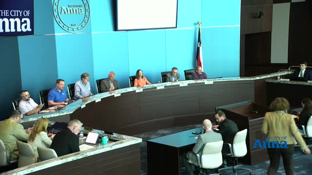
Anna council adopts 2050 comprehensive plan update after public hearing
Summary
At its March 25 meeting the Anna City Council voted unanimously to adopt updates to the city's comprehensive plan, a nonbinding policy document that guides future land use and place-type designations through 2050.
Anna City Council unanimously approved an updated comprehensive plan on March 25, 2025, after a public hearing and questions from council and residents.
The update, presented by Director of Development Services Stephanie Scott Sims and consultant Reid Cleeter of Kimley-Moore, revises place types and the future land use map to reflect rapid growth and new infrastructure since the plan's 2021 adoption. The council cast a unanimous vote to adopt the 2050 comprehensive plan update.
The plan is a policy document intended to state the community's long-range vision and guide decisions about future land use, transportation and public facilities; it does not establish zoning or create legally binding zoning districts. Stephanie Scott Sims told the council the update reduces the number of place types from 12 to 10, clarifies transitions between rural, estate and suburban residential areas, and adds mapping for floodplain and riparian open space.
Consultant Reid Cleeter said the update reflects six months of engagement including two joint Planning & Zoning/city council workshops, a community open house and an online survey. The outreach produced more than 430 unique touchpoints, nearly 100 attendees at the open house and roughly 350 survey responses; 98% of respondents reported living in Anna. Cleeter said the update eliminated an earlier 'preferred scenario' that looked to ultimate buildout and instead focuses the future land use plan to 2050 to reduce confusion.
Council members and the public discussed specific place-type changes. The plan retains 'rural living' on the far edges of the city, reclassifies some previously shown suburban areas as 'estate residential', and identifies regional activity centers and employment or manufacturing/warehouse areas along the 121 corridor and at major future intersections. The update also maps the 100-year floodplain to indicate undevelopable or constrained open space.
At the public hearing Terrell Culberson of County Road 289 thanked council and staff for incorporating resident input and said he felt the process had 'heard' neighborhood concerns. Council members who spoke during the meeting praised staff and the consultant for iterative outreach and said the adopted plan better reflects community preferences than the prior document.
Council members emphasized that the comprehensive plan is advisory. One council member urged residents and property owners to remember the plan 'does not constitute zoning regulations' and that changes to land use will require future zoning actions and developer engagement.
The council approved the plan by unanimous vote; no conditions were attached. The city will make the final adopted document available to residents and use it to guide future zoning, capital improvements and annexation discussions.
Anna City staff said updated map products and a highlighted-change log will be provided to the public to show what text and map areas were revised in the update.
Supporters and opponents of individual parcel outcomes retain procedural paths: specific zoning requests or developer-initiated changes will still require separate public hearings and formal approvals.
AI generated
The text on this page is AI generated. Summaries, highlights, analysis, and video transcripts are all produced from the original source material.
AI can make mistakes, so if you spot one, and we will fix it for everyone.
Note: the source content is unaltered by us. Any content source we link to, be it a video, an audio recording, or a document, is presented exactly as its publisher released it. That publisher is usually a government body, sometimes an individual official or another organisation.