Get Full Government Meeting Transcripts, Videos, & Alerts Forever!
Get email alerts on the Executive Park topic
No spam. Unsubscribe anytime.
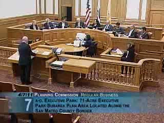
Planning Commission initiates Executive Park subarea amendments to allow higher-density residential plan
Summary
The commission initiated general plan, planning-code, and zoning-map amendments for the Executive Park subarea, advancing staff's proposal to rezone an office park to RC-3 and create an Executive Park Special Use District with new street grid, open-space framework, and height/bulk provisions that allow higher-density residential development.
The San Francisco Planning Commission on April 7 voted to initiate a set of land-use changes for the Executive Park area in the southeast part of the city, advancing staff's proposal to convert an office park into a higher-density mixed residential neighborhood.
Planning staff presented the revised Executive Park Subarea Plan, noting three implementation tools before the commission: a general-plan amendment, planning-code text amendments, and zoning-map amendments. "Initiating these items will allow staff to schedule an approval‑period hearing and appropriate notification for those actions," said department staff presenting the proposal.
The package includes rezoning the area currently designated C2 to RC‑3 (residential‑commercial medium density), creation of an Executive Park Special Use District (SUD) to shape block and street patterns, and new height and bulk controls that would permit taller buildings in targeted locations. Staff described a new street hierarchy, a publicly accessible open-space network tied into the hillside and bay edge, and design guidelines intended to produce well-modulated facades, robust public frontages and higher sustainability standards.
Commissioners pressed staff on illustrative imagery, street-section dimensions, pedestrian crossings and transportation assumptions for Harney Way; staff acknowledged some images were analogies and committed to clarifying sections and to provide more detailed streetscape proportions before hearings on entitlements. Commissioner Moore raised pedestrian-safety concerns across Harney Way and requested clearer signalization and crossing design; project representatives and transportation consultants said intersection design and phasing were being coordinated with traffic planners.
The motion to initiate the amendments was made by Commissioner Bridal, seconded, and passed by roll call, formally allowing staff to proceed with the next phase of public noticing and subsequent hearings. As staff emphasized during the presentation, the initiation does not approve specific development projects; it authorizes further entitlement and design-review processes that would bring individual proposals back to the commission.
Matt Snyder of the Planning Department told commissioners the SUD would require that each new phase of building include associated new streets and open space, and that the design guidelines would be used where the planning code is silent. "The SUD will also refer to the Executive Park design guidelines for further controls," he said. The commission directed staff to refine street sections and imagery before returning with formal draft ordinance language and environmental review materials.
Next steps: staff will prepare detailed zoning and general‑plan amendment language, schedule the required public hearings, and circulate materials for further review. The initiation vote opens a pathway for the city to consider the project's detailed design and environmental review; actual development projects will come back as discrete applications.