Get AI Briefings, Transcripts & Alerts on Local & National Government Meetings — Forever.
State study maps Great Salt Lake flood risks; FEMA review and local permitting process outlined
Summary
State emergency management and AECOM presented a statewide Great Salt Lake flood‑risk mapping study that models surge and wave effects around the lake, identifies still‑water elevations and transect‑based wave zones, and will enter FEMA review before communities use it for permitting.
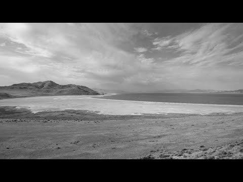
A statewide flood‑risk study of the Great Salt Lake designed to give communities consistent data for permitting and floodplain management was presented to the Great Salt Lake Tech Team on Sept. 1. Jamie (identified in the transcript as both "Jamie Huss" and "Jamie Heff") of the Utah Division of Emergency Management said the project began after a request from Salt Lake County and expanded to five counties to produce a unified dataset for local use.
The study team, led by consulting firm AECOM and presented by Tom Wright of AECOM, described a full‑circle ADCIRC model coupled with wave and transect (WAFIS/SWAN) analyses to capture surge and wave action at the shoreline. Wright said the lake’s shallow depth and high salinity required modifications to coastal modeling code and that the team ran analyses in 36 directions to capture wind‑driven surge. “FEMA does not allow [future‑condition] projections,” Wright said, explaining why the study models current conditions rather than hypothetical future lake levels.
Why it matters: the maps are intended to harmonize flood hazard identification around the lake and provide a single source of best‑available information communities can use in permitting and to size embankments or set construction standards. The presenters emphasized the product is diagnostic — it identifies hazard zones and still‑water elevations and does not itself prescribe mitigation measures, which local regulators would determine.
Key findings and numbers presented: the team reported a 1% (100‑year) volume estimate corresponding in their slides to roughly 30,110,000 acre‑feet and quoted still‑water elevations (presented in the slide text as approximately '42 14.82' for the 1% event and '42 16.04' for a 0.2%/500‑year event). The team said surge and wave analysis raised edge elevations locally (in some transects the surge reached about elevation '42 19–42 20') once waves were added to still water.
Presenters highlighted a site‑specific finding about the railroad causeway: modelers noted parts of the causeway have subsided and estimated some sections may have sunk by as much as 8 feet, reducing its capacity to break up waves and changing flow connectivity between the north and south arms.
Next steps and process: the study will feed into FEMA map products. Jamie described a multi‑step FEMA review, preliminary release with appeal opportunities, and a six‑month adoption period. The presenters estimated the final effective maps could be several years away, noting the review and due‑process timeline is lengthy.
What the study does not do: modelers said they do not prescribe mitigation projects; instead, the dataset is non‑regulatory until formally adopted by FEMA and used by local floodplain managers. They also said FEMA’s rules preclude treating proposed projects or hypothetical causeway restorations as existing conditions in the insurance‑linked products, though the state can produce separate non‑regulatory future‑condition maps if communities request them.
Public and member reaction: Council members pressed on tributary inclusion (presenters said the team is modeling ~32–36 tributaries and about 84 miles of riverine interface), the role of vegetation in reducing wave heights, and whether the new maps would expand flood footprints in previously unmapped counties. Presenters said areas such as Tooele and Box Elder will see new mapped footprints where prior data were sparse.
The panel closed by encouraging community engagement during the FEMA preliminary process and reminding local officials that appeals must be supported by data. The tech team will make draft panels available for review before maps become effective.