Lifetime Citizen Portal Access — AI Briefings, Alerts & Unlimited Follows
Westborough outlines MassDOT-funded East Main Street shared-use path; residents flag safety and property concerns
Loading...
Summary
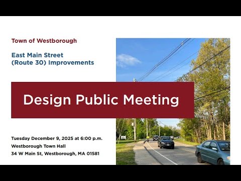
Town of Westborough DPW and consultants presented a MassDOT-funded plan for an 8-foot shared-use path along East Main Street (Hastings Elementary to Thomas Newton Drive), estimated at about $8.8 million and programmed for FY2030; residents raised questions about snow removal liability, mailbox relocations, retaining walls and a narrow Route 9 underpass.
At an informational meeting, Town of Westborough Department of Public Works staff and consultants presented a conceptual design for an 8-foot shared-use path along East Main Street from Hastings Elementary School to Thomas Newton Drive, funded through MassDOT and currently estimated at about $8–9 million.
The presentation, led by Chris Pant of the Department of Public Works and consultants from Howard Stein Hudson, said the project is in the early stages and is programmed in MassDOT’s Transportation Improvement Program for fiscal year 2030. "This project is in the very, very early stages," Pant said, emphasizing that the purpose of the meeting was to gather public feedback before detailed design begins.
Why it matters: the proposal pairs multimodal pedestrian and bicycle improvements with corridor repaving and safety measures to address longstanding vehicle-pedestrian conflicts, particularly at the East Main Street–Flanders Road intersection. Angela Blaker, the project traffic engineer, said the plan includes four new crossings (trolley-line trail, the U.S. Postal Service driveway, McDonald’s driveway and Windsor Ridge Drive) and a traffic signal with an exclusive pedestrian phase at Flanders Road to improve safe crossings.
The consultants described a typical corridor cross-section of two 11-foot travel lanes, 4-foot shoulders and an 8-foot shared-use path with a 2-foot buffer. Consultants said MassDOT’s standard for a shared-use path on a state-funded corridor is 10 feet, but the team plans to request a waiver and start design at 10 feet while seeking approval to construct an 8-foot path. Chris Lyman of Howard Stein Hudson said MassDOT has been "very okay with going to 8" in preliminary conversations; staff also said the Route 9 underpass is constrained and MassDOT verbally accepted a 6-foot sidewalk under the bridge as a temporary measure to avoid expensive bridge reconstruction.
Design, easements and impacts: the team stressed that most of the path fits in existing town right-of-way, but a few parcels (called out in the presentation by address) will require permanent easements where the shared-use path encroaches on private property. Lyman described both temporary construction easements for grading and small permanent easements for utilities and signal equipment, and said final grading, retaining-wall work and exact footprint will be defined at the 25% design milestone.
Residents asked detailed questions about maintenance, safety and property effects. A homeowner at 198 East Main Street asked whether property owners would be required to clear an 8-foot path in winter; staff said sidewalk plowing policy will be clarified before construction and indicated the town "would probably end up being" the party that plows this path but made no final commitment. A resident describing the underpass noted the current pedestrian clearance is roughly 3–4 feet and asked how two cyclists could pass; staff repeated that MassDOT agreed to a 6-foot width under the bridge for now to avoid replacing the bridge within this project.
Other concerns included potential flooding and retaining-wall replacement where older stone walls are present. A homeowner worried that replacing a retaining wall and regrading could increase basement flooding; consultants said affected stone walls would be re-built or reinforced and that detailed grading plans would be prepared at 25% design.
Traffic effects were discussed at length. Staff said the proposed signal at Flanders Road is intended to improve safety and allow protected pedestrian phases, and that a later operations analysis will evaluate adjacent intersections to limit queue spillback. Angela Blaker noted East Main Street carries about 16,000 vehicles per day in the corridor and that truck turning movements limit some options (for example, center refuges at the Route 9 ramps were judged infeasible because of truck paths).
Cost and schedule: consultants said the reduced, shorter project was submitted to secure funding after an earlier, longer proposal (to Walker Street) was estimated near $12.5 million and considered less competitive. The current construction estimate cited to MassDOT is roughly $8.8 million; the town is funding design through Chapter 90 funds and has previously spent several hundred thousand dollars on early work. The team outlined a design schedule that targets 25% design submission this summer (public design hearing to follow), 75% and 100% design submissions through 2028, and bidding/construction timing aligned with the FY2030 funding year.
What’s next: staff will post updated plans and a right-of-way impact table on the town project website, refine property-impact depictions before the 25% milestone, and hold a formal design public hearing once 25% designs are complete. Consultants urged residents to submit comments by email or via the project website.
The meeting closed with staff noting that many technical issues will be resolved in later design phases and that public input will be used to refine grading, curb placement, mailbox locations and other details.