Get AI Briefings, Transcripts & Alerts on Local & National Government Meetings — Forever.
Agency official details Rocky Flats automated surface‑water monitoring and reporting rules
Loading...
Summary
An agency official described automated, telemetry‑linked 'flow‑paced' samplers at Rocky Flats that collect aliquots when flows occur, the analytes tested (plutonium, americium, uranium and nitrate) and the RFLMA thresholds that would trigger consultation with state and federal regulators.
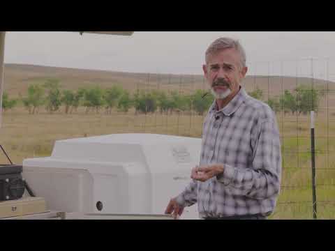
An agency official at the Rocky Flats site described how automated sampling systems monitor surface water at the confluence of three local drainages and how the program flags and reports any exceedances under the Rocky Flats Legacy Management Agreement.
The official said the three drainages—No Name Gulch, North Walnut Creek (from Pond A4) and South Walnut Creek (from Pond B5)—join at a monitored flume, and that flow is recorded by a flow meter that programs a sampler to take small aliquot samples. "The analytes here include plutonium, americium, uranium, and nitrate," the official said.
Why it matters: those analytes are among the radiological and chemical contaminants the site tracks to ensure the cleanup remedy remains protective. The official emphasized the monitoring system is automated, telemetry‑linked and run on battery and solar power, which allows remote oversight and more consistent samples than occasional manual bottle sampling.
How the system works: the official said the flume has a known geometry and automated equipment measures depth to calculate flow rate; that flow rate instructs the sampler when to collect a small grab (an aliquot); and that the samplers remain in place year‑round rather than being turned off. According to the speaker, sampling frequency varies by site history and season: flows tend to be higher in spring and lower in fall and winter, and many streams at the site are ephemeral—often dry from about June until February or March.
On reservoir connections and public supply: the official said water from the site once flowed to Great Western Reservoir, which formerly served Broomfield for drinking water, but that the reservoir has been bypassed since the 1990s and early 2000s. The city and county of Broomfield may choose to route water into Great Western for nonpotable uses (such as irrigation) or to let it bypass the reservoir, the speaker said.
Reporting triggers and oversight: the official explained that Rocky Flats monitoring follows the Rocky Flats Legacy Management Agreement (RFLMA) standards. Data are evaluated using rolling 12‑month and 30‑day averages; if an analyte meets the criteria for a reportable condition, the Department of Energy notifies the Colorado Department of Public Health and Environment and the U.S. Environmental Protection Agency and the agencies conduct a consultation to discuss causes and potential responses.
The official also distinguished upstream "points of evaluation," used to track trends, from downstream "points of compliance," which are specifically tied to remedy protectiveness and carry the more critical reporting obligations. The monitoring systems described remain in place, and the official said samples are collected when flows occur rather than being turned off during dry periods.