Get Full Government Meeting Transcripts, Videos, & Alerts Forever!
Get email alerts on the Mapping Tools topic
No spam. Unsubscribe anytime.
Census Bureau webinar demos mapping tools on data.census.gov
Summary
The U.S. Census Bureau held a public webinar demonstrating map-building on data.census.gov, including selecting geographies, applying table variables (ACS and County Business Patterns), exporting maps, and limitations such as single‑year selection and no pin drop functionality.
Deb Rivera, the webinar host, opened the session and handed the presentation to Noemi Mendez of the Census Bureau’s Center for Enterprise Dissemination, Dissemination Outreach Branch. "My name is Noemi Mendez," Mendez said as she outlined the session’s goals: selecting geographies, mapping census tracts, mapping business data, and searching by address.
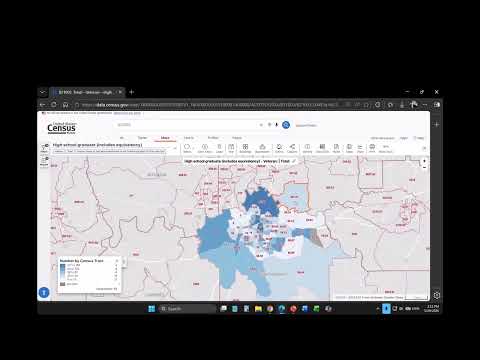
Mendez demonstrated how to build maps from table data on data.census.gov, starting with American Community Survey tables for census tracts. Using Montgomery City, Alabama as an example, she showed how to select all census tracts within a place, load table CB21003 (veteran status by educational attainment for civilians 25 and over), and map the number of veterans with a high‑school diploma (including equivalency). The presentation highlighted the site’s "within other geographies" filter, select tools (box, circle, lasso), and the identify tool that returns GEOID and block/tract metadata.
She switched to economic data to show County Business Patterns for Colorado counties, selecting NAICS code 44‑45 (retail trade). The map first displayed the number of retail establishments by county, then was changed to show number of employees, illustrating how different variables (establishments vs. employees) change spatial patterns on the map.
On address-based searching, Mendez demonstrated zooming to a street in Palmyra Borough, New Jersey, overlaying census tracts and block groups and reading the GEOID (example: census tract 7001.02, block group 1, Burlington County). She explained that block groups nest within tracts and that ZCTAs (ZIP Code Tabulation Areas) are Census approximations useful for demographic tables, while five‑digit ZIP geography is typically used for business/economic datasets.
During the Q&A, Mendez confirmed several current limits and behaviors of data.census.gov. In response to whether users can select multiple years (for example, 2023 and 2024), she said, "No, not currently in data.census.gov," noting the year filter allows only one year at a time. Asked how print areas are defined, she explained exports render a map image (pixel range) and contrasted the site’s smaller PDF output with larger, high‑resolution geography PDFs available elsewhere on Census pages. On a request to drop pins for landmarks or addresses, Mendez said the function is not available now and suggested participants submit the idea as developer feedback: "we don't currently have that functionality."
Mendez also walked attendees through table features: downloading tables, getting citations or API calls, changing columns or transposing, switching between percentage and estimate views, and applying color schemes (sequential, diverging, qualitative). She directed attendees to resources including the Census Academy, recorded webinar materials, video tutorials, and two contact emails for follow‑up questions or training requests (census.data@census.gov and ced.cedsci.outreach@census.gov). She invited users to sign up for hands‑on three‑hour workshops and to volunteer for 60‑minute virtual usability studies.
The webinar closed with a reminder that the session was recorded and that participants should complete the post‑webinar evaluation that appears on exit. Materials and tutorial links will be posted via the Census Academy resources page, and the presenters encouraged attendees to send questions or feedback by email.