Lifetime Citizen Portal Access — AI Briefings, Alerts & Unlimited Follows
Oak Ridge staff outline LandScan Global’s shift to machine‑learning and near‑real‑time population estimates
Loading...
Summary
Oak Ridge National Laboratory presenters described updates to the LandScan Global population model, saying a move to machine‑learning methods and rapid-update estimates will improve accuracy, lower run time and help military and humanitarian responders target aid.
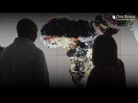
Oak Ridge National Laboratory staff described updates to the LandScan Global population modeling program during a technical presentation. They said the effort now uses machine‑learning models and aims to produce near‑real‑time population estimates to support military planning and humanitarian response.
Presenters framed the work as a practical response to global instability. A staff member at Oak Ridge National Laboratory said militaries and partner nations "need to understand where populations are and how their activities can impact them," and argued that temporally specific population data can improve operational and relief decisions.
The presenters said the program replaced older modeling approaches with machine‑learning methods to reduce run times and improve accuracy and explainability. One presenter summarized the change this way: the team "replaced our models with mission learning models" in the transcript; presenters described those changes as delivering faster updates, better accuracy and clearer model explanations. Another presenter said the program’s "rapid updates" capability is focused on "creating these near real time population estimates that reflect how populations respond" to political conflicts or natural disturbances.
Speakers emphasized several data and modeling priorities that support those aims: integrating building‑level and other high‑resolution data to avoid distributing census counts uniformly across large areas; incorporating cultural and weekly activity patterns that change movement; and combining multiple data stacks to enable modeling at different spatial and temporal scales. Presenters said they also plan to forecast population datasets based on historical behavior.
Officials linked the technical work to real‑world use. Presenters repeatedly cited military planning and humanitarian aid as principal use cases and said the multidisciplinary team at Oak Ridge National Laboratory supports producing LandScan products for the U.S. government. One speaker said the work "helps people who truly need the help," and another described the program’s agility in pulling in new datasets and capabilities to respond to emerging needs.
The presentation did not include formal actions, votes or named outside statutes. Presenters identified technical priorities and goals and said the next steps are continued model development and rapid‑update implementation.